
Ask people in Seattle where they live and they might say “the Pacific Northwest” or “the Puget Sound”. Very few people will say “the Salish Sea”. Why? Most people have not heard of it yet. In March 2019, a survey of more than 2,400 residents showed that only 5% of Washingtonians and 14% of British Columbians knew where it is located.1
To illustrate that point, check out this light-hearted video (3 min. runtime) of a man in an Orca suit asking people in Seattle if they know how to get to the Salish Sea:
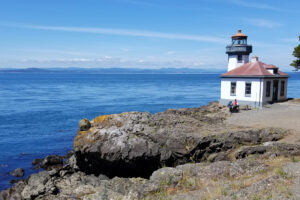
It’s not their fault. “The Salish Sea” has only been formally recognized by the US and Canadian governments since the winter of 2009/2010, and even in the digital age, news doesn’t always travel quickly.2 I didn’t know until a few years ago either. So, in case you didn’t know…if you live near Seattle, Olympia, Neah Bay or Port Angeles in Washington State, or near Victoria, Vancouver, or Campbell River in British Columbia, you live near the Salish Sea!

Where is it?
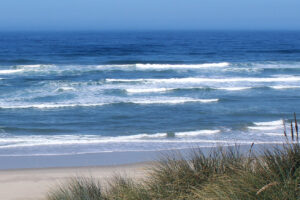
The Salish Sea is an inland marine ecosystem located at the northeast edge of the Pacific Ocean, the northwest corner of the continental United States, and the southwest corner of Canada. It “extends from the north end of the Strait of Georgia in British Columbia, Canada, to the south end of Puget Sound in Washington in the U.S., and west to the mouth of the Strait of Juan de Fuca where it meets the Pacific Ocean.”3 These three bodies of seawater, the surrounding watershed basin that drains fresh water into them, and the air above them form an integrated ecosystem. Despite its many parts, we now look at it as a unified ecosystem so that we may better understand and manage its health.
Show me the map

For all of us map lovers out there, the boundaries of the Salish Sea define approximately 79,500 sq. mi. Of that, 11,200 sq. mi. are seawater and 68,300 sq. mi. are the watershed basin that drains fresh water into it (not including the Upper Fraser River in Canada). The system reaches from a depth of 2,160 ft. to an elevation of 14,411 ft. at the top of Mt. Rainier.4
For my Canadian friends, here it is in metric units. 🙂
The boundaries of define approximately 128,000 sq. km. Of that, 18,000 sq. km. are seawater and 110,000 sq. km. are the watershed basin that drains into it (not including the Upper Fraser River in Canada). The ecosystem reaches from a depth of 660 meters to an elevation of 4,392 meters at the top of Mt. Rainier.4
So, in case you didn’t already, now you know where you live! 🙂 Now that we know where it is, we can work to restore and protect it.
Go Deeper!
Go Deeper to explore the ocean and the Salish Sea through a curated list of articles, books, films, and other resources.
To learn more about the topic in this article, check out the following resources:
- Dr. David J. Trimbach. Oregon State University. May 2019. Salish Sea Survey
- SeaDoc Society. About the Salish Sea
- Stefan Freelan. Map of the Salish Sea & Surrounding Basin
End Notes
1 Trimbach, David J. “Salish Sea Survey: Final Report.” The SeaDoc Society, UC Davis School of Veterinary Medicine, May 2019.
2 Webber, Bert. “How the Salish Sea Got Its Name.” SeaDoc Society. Accessed July 1, 2020. http://www.seadocsociety.org/how-the-salish-sea-got-its-name/.
3-4 Freelan, Stefan. “Map of the Salish Sea & Surrounding Basin.” Maps by Stefan Freelan, 2009. http://maps.stefanfreelan.com/salishsea/.
Leave a Reply
Your comments are welcome.