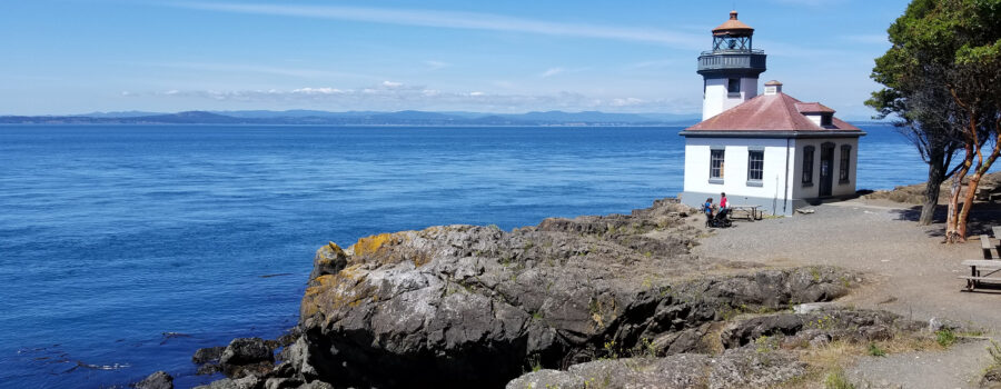
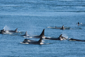
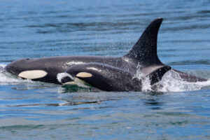
I visited San Juan Island at the end of June. It sits in almost the exact middle of the Salish Sea and feels a world away. If you go, especially in the summer, you need to spend time at the Lime Kiln State Park on the west side of the island. The park boasts a small, quaint lighthouse, some picnic tables, and a few benches. So, why is this place special? If you are very lucky, you will see orcas swim by at close range.
Best spot in the world
I wasn’t lucky enough to see them on my visit, but I was told by folks at the Whale Museum that they think this spot by the lighthouse is the best place anywhere in the world to see orcas while you are standing on land. I don’t think they are exaggerating.
You might have the best chance of seeing them from a boat because you can move to where the whales are. The commercial whale watch crews know where to look for the orcas when they take you out on whale watch excursions. That said, you likely won’t see them up close. Canadian and US law prohibit boats from coming within 300-400 yards of the orcas,1 and there is mounting pressure to increase those distances. The only way you’ll get close to them is if they choose to approach the boat. And thank goodness for that! We need to give them space so they can feed and mate without the stress of being hounded by boat engines. (I’ll save a discussion of underwater noise for another article.)
So why would viewing them from one point onshore be any better? Because the orcas, or Minke Whales or porpoises, for that matter, can come very close to shore. By very close I mean 20 feet away. Seriously. Orcas can swim through shallow water, but deeper water allows them more freedom. The water is deep here. Really deep. In fact, the bathymetry (underwater topography) here is dramatic.
Standing on a drop-off
Just off the rocks, there is a bull kelp bed. The long stems of bull kelp generally grow in 30-60 feet of water.2 Just on the other side of the kelp bed, the seafloor plummets. Go out another 350 yards or so and the water reaches 150 fathoms or nearly 900 feet deep.3 When you stand at sea level on the western shore of San Juan Island you are actually standing on the edge of a steep drop-off. The whales have no problem swimming up close to the shoreline where people with exquisite timing can see them up close.
Here is an elevation profile (cross-section) of the Haro Strait at the Lime Kiln Lighthouse that I generated using Google Earth Pro.

The white line is the cross-section of the Strait. The yellow line is the border between Canada and the US. The tool exaggerates the depth on the vertical axis so that you can see the shape of the seafloor more easily, so this looks steeper than it is, but nonetheless it’s still very steep. Here is a close up of the profile on the San Juan Island side of the Strait with additional labels to help clarify:

The Haro Strait was carved out by multiple ice sheets during the Ice Ages. (See the blog article titled “How was the Salish Sea formed?” to learn more about its geologic history.) It is one of several deep fjords that bring cold, nutrient-rich water from the Pacific into the Salish Sea. It also serves as a superhighway for salmon returning to spawn in the rivers that drain into the Sea from the watershed. When the Southern Resident orcas are here, they are likely in pursuit of Chinook salmon heading north into the Fraser River system.
So close…
What does standing 20 feet away from a pod of orcas feel like? I wish I could say from personal experience, but it looks like magic. See for yourself in this video produced by Amanda Johnson with footage from Dr. Robert Otis. He has studied the whales at Lime Kiln State Park for more than 20 years and teaches through The Whale Museum’s Marine Naturalist Training Program4 (run time 06:52):
Bob Otis and other researchers occupy the lighthouse throughout the summer months. They observe the whales and carefully document what they see. Which pods are here? Which individuals? What are they doing? Leading? Following? Spy-hopping? Breaching? Kelping? Tail Lobbing? Researchers are also analyzing sounds from the SeaSound Remote Sensing Network, an underwater array of hydrophones that are stationed here to capture orca vocalizations. Bob and his team are responsible for a lot of our understanding of the Southern Residents’ behavior.
Seeing the orcas here is on my bucket list. If I have to camp out at Lime Kiln Lighthouse for days one summer to get a glimpse of them, I will. I want to see, hear, and feel the magic myself.
Go Deeper!
Go Deeper to explore the ocean and the Salish Sea through a curated list of articles, books, films, and other resources.
To learn more about the topic in this article, check out the following resources:
- Center for Whale Research. Orca Behaviors
- The Whale Museum
- Orca Sound Recordings. Discovery of Sound in the Sea
End Notes
1 “Home.” Be Whale Wise, www.bewhalewise.org/.
2 “About Bull Kelp.” Montereybayaquarium.org, www.montereybayaquarium.org/animals/animals-a-to-z/bull-kelp/.
3 “Haro Strait – Middle Bank to Stuart Island NOAA Chart 18433.” https://www.charts.noaa.gov/BookletChart/18433_BookletChart.Pdf, National Oceanic and Atmospheric Administration, p. 14.
4 “Explore The Museum.” The Whale Museum, whalemuseum.org/pages/conservation-research.


Leave a Reply
Your comments are welcome.