
In February 2010, the “Salish Sea” name was announced by the last governing body required for approval. This capped a naming effort that began in 1971.1 Governing bodies within the First Nations of British Columbia, Canada, Washington State Tribes, and the United States were all involved in the naming process. Hence the nearly 40-year decision-making process, I suppose.
Before 2010
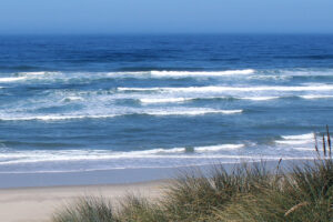
Prior to the naming, we talked about this region as a collection of separate yet neighboring systems. Using the familiar names of the Puget Sound, Strait of Georgia, Strait of Juan de Fuca, San Juan Islands, and Fraser River, we measured the health and set management policies for each system independently. The latter proved particularly tricky as this region spans the national border between Canada and the United States.
A whole that is greater than the sum of its parts
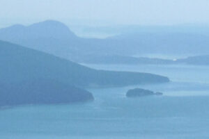
The need to manage the risk of potential oil spills prompted people to look at the ecosystem as an integrated whole. They feared, probably correctly, that we could not effectively respond to an oil spill emergency if Canada and the US were not working together. In the mid-1970s, oceanographers, chemists, and biologists began to study the circulation, salinity, and marine life throughout the inland sea and its watershed basin. They found that it could be understood as a single food web. That single integrated food web became the thing that needed protection from oil spills. After all, neither oil spills nor marine life recognize lines on a map.

Coming together
The first step in coordinating an emergency response is for all parties involved to have a common understanding of the scope of the area that is at risk. It needed a name.
A scientist named Bert Webber proposed the name “the Salish Sea” to the Board of Geographical Names in 1989, but the Board wouldn’t consider the request at that time. Informal usage of the name started to gain momentum in the following years. Then the First Nations of British Columbia and Washington State Tribes became the first to formally recognize it as the name of their homelands in 2005.2

Source: Noahedits / CC BY-SA
They worked together with Bert Webber and teams of other scientists to persuade the county, state, provincial and national governments of Canada and the U.S. to formally recognize the Salish Sea in the winter of 2009/2010.
All of us who live here, do so on the ancestral lands of the Coast Salish peoples who have lived along the shores of this inland sea for thousands of years. The name is an honorable acknowledgment of those first and current stewards of this ecosystem. All of us who live here today are responsible for working together to restore the health of our home – the Salish Sea.
Go Deeper!
Go Deeper to explore the ocean and the Salish Sea through a curated list of articles, books, films, and other resources.
To learn more about the topic in this article, check out the following resources:
- Map of Native Lands
- Bert Webber. SeaDoc Society. How the Salish Sea Got its Name
- Stefan Freelan. Map of the Salish Sea & Surrounding Basin
- Deep Green Wilderness. The Unknown Sea: A Voyage on the Salish
End Notes
1 Webber, Bert. “How the Salish Sea Got Its Name.” SeaDoc Society. Accessed July 1, 2020. http://www.seadocsociety.org/how-the-salish-sea-got-its-name/.
2 Webber, Bert. “How the Salish Sea Got Its Name.” SeaDoc Society. Accessed July 1, 2020. http://www.seadocsociety.org/how-the-salish-sea-got-its-name/.
Leave a Reply
Your comments are welcome.